
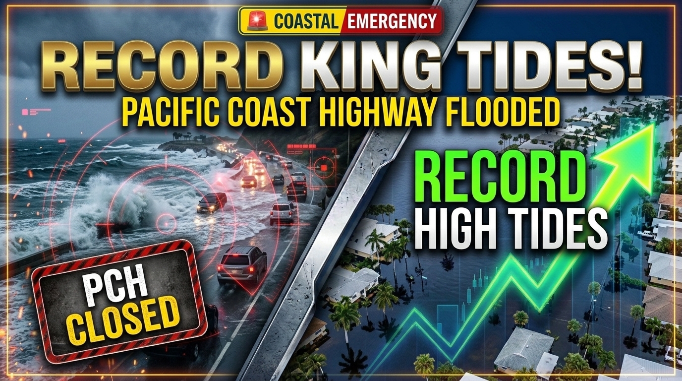
Record King Tides Flood California and Florida Coasts and Close Part of Pacific Coast Highway
Introduction: Coastal Communities Overwhelmed by Rising Seas
A dramatic convergence of astronomical alignments, oceanic warming, and atmospheric conditions has unleashed unprecedented tidal surges along both major U.S. coastlines. State transportation departments and local emergency agencies confirmed that record king tides flood California and Florida coasts and close part of Pacific Coast Highway as seawater spilled over protective seawalls, submerged coastal neighborhoods, and inundated major transportation arteries.
In Southern California, seawater surged across low-lying beach towns, forcing transit officials to shut down key sections of the iconic Pacific Coast Highway (PCH/State Route 1) near Sunset Beach and Huntington Beach. Concurrently, low-lying communities along South Florida’s Atlantic shoreline and the Florida Keys experienced severe “sunny day” flooding, with seawater inundating urban storm drains, residential streets, and commercial districts. The dual-coast flooding event has re-energized national debates regarding coastal infrastructure resilience, climate-driven sea-level rise, and long-term emergency response strategies.
Also Read:
Brent Tops $117 After Mine Attack on Tanker in Strait of Hormuz
The Pacific Surge: PCH Shutdowns and California Inundation
The Pacific coastline experienced some of its highest water level readings on record. Water levels reached back-to-back historic peaks at key monitoring stations, including the San Pedro tide gauge in Los Angeles Harbor and regional gauges across San Diego and the San Francisco Bay Area.
Pacific Coast Highway Closure: Seawater overwhelmed coastal barriers in Orange County, flooding several lanes of the Pacific Coast Highway in Huntington Beach and Sunset Beach. Caltrans maintenance crews were deployed to close affected sections, reroute commuter traffic, and clear debris, sand, and ocean saltwater from flooded asphalt.
Neighborhood Impact: Residents in Newport Beach, Balboa Island, and Sunset Beach woke up to flooded driveways and submerged ground-level structures, with localized transport temporarily taking place via kayaks and paddleboards.
Protective Sand Berms: Municipal public works teams mobilized heavy earth-moving equipment along urban beaches to construct emergency sand berms to protect beachfront homes and boardwalk infrastructure from continued tidal overwash.
[Astronomical Perigee Alignment] ---> [Thermal Expansion & Oceanic Heatwaves] ---> [Record Tidal Surges] ---> [PCH Closures & Urban Inundation]
Florida’s Atlantic Coast: Severe Nuisance Flooding
While California contended with pacific swell energy and high astronomical tides, Florida’s low-lying Atlantic coastline suffered intense tidal inundation amplified by regional wind patterns.
Coastal municipalities from Miami-Dade and Broward counties up to Saint Augustine recorded widespread saltwater intrusion. The combination of seasonal perigean spring tides (king tides) and high ocean temperatures caused seawater to back up through municipal stormwater systems, turning arterial roadways into standing saltwater channels during peak morning high tides.
1. Urban Infrastructure Strains
In South Florida, floodwaters disrupted daily transit routes and inundated low-elevation parking garages. Municipalities deployed portable high-capacity industrial pump trucks and checked non-return tidal valves to accelerate water displacement back into coastal bays.
2. Saltwater Intrusion Concerns
Environmental engineers expressed concern regarding prolonged saltwater exposure to underground utility conduits, building foundations, and coastal freshwater aquifer recharge zones. Extended standing water conditions accelerate vehicular corrosion and pose long-term maintenance hurdles for low-elevation civil infrastructure.
| Impacted Region | Key Infrastructure / Highways Affected | Primary Environmental & Meteorological Factors |
| Southern California (Orange / LA Counties) | Pacific Coast Highway (PCH), Sunset Beach, Newport Beach boardwalks | Record tides, thermal expansion, coastally trapped Kelvin waves |
| Northern California (Bay Area / San Diego) | San Francisco waterfront, Mill Valley roads, La Jolla shoreline | Record monthly tide readings, high ocean heat index |
| South Florida (Miami / Fort Lauderdale) | A1A coastal corridors, low-lying municipal residential streets | Perigean spring tides, stormwater backflow, regional wind pushes |
Scientific Drivers Behind the Record Water Levels
Meteorologists and oceanographers from the National Oceanic and Atmospheric Administration (NOAA) highlight that king tides are predictable astronomical phenomena that occur when the moon is at its closest distance to Earth (perigee) during full or new moon phases. However, the unprecedented severity of this year’s tidal surges stems from compounding oceanographic forces:
Thermal Expansion: Abnormally warm sea-surface temperatures across the Pacific and Atlantic cause water molecules to expand, raising baseline sea levels several inches above historical averages prior to astronomical tides.
Kelvin Waves: A coastally trapped Kelvin wave—a deep surge of warm water moving northward along the Pacific coastline—added extra water height along California shores.
Climate-Driven Baseline Rise: Long-term global sea-level rise means modern king tides start from a significantly higher baseline than those recorded in past decades, converting standard high tides into damaging flood events.
Frequently Asked Questions (FAQs)
Q1: Why did record king tides flood California and Florida coasts and close part of Pacific Coast Highway?
A: The flooding resulted from a rare convergence of astronomical perigean spring tides, long-term sea-level rise, elevated ocean temperatures causing thermal expansion, and coastally trapped ocean waves.
Q2: Which specific parts of the Pacific Coast Highway were shut down?
A: State officials closed key stretches of the Pacific Coast Highway (Highway 1) in Southern California, particularly around Sunset Beach and Huntington Beach in Orange County, due to severe saltwater inundation.
Q3: What are “king tides”?
A: King tides are non-scientific, popular terms used to describe exceptionally high tides that occur when the earth, moon, and sun align at their closest orbital points (perigee spring tides).
Q4: How long do king tide flooding events typically last?
A: King tide flooding typically peaks during high tide windows over a period of 2 to 4 consecutive days, though water recedes during low tide cycles between peak events.
Disclaimer
Disclaimer: This article synthesizes environmental monitoring reports, state department of transportation advisories, and weather disclosures regarding U.S. coastal flooding events as of late October 2026. Coastal conditions, highway road statuses, and local advisories remain subject to real-time meteorological changes.