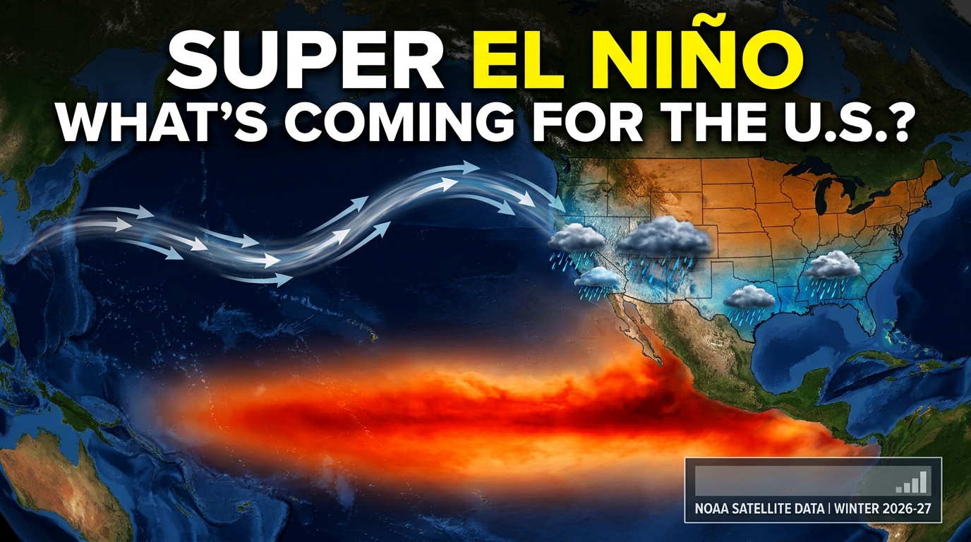
Super El Niño 2026: Fall and Winter Weather Impacts Across the United States
Global climate tracking networks and meteorological agencies have raised critical alarms as the tropical Pacific Ocean experiences an unprecedented, rapid surge in sea surface temperatures. The U.S. National Oceanic and Atmospheric Administration (NOAA) and its Climate Prediction Center have officially issued a high-confidence advisory noting a greater than 90% chance of a very strong Super El Niño 2026 developing and peaking during the Northern Hemisphere fall and winter. Meteorological models indicate a strong 75% probability that this event could achieve historic proportions, potentially surpassing the intensity of past benchmarks dating back to 1950.
Also read:
Apple AI Hardware Integration and Lineup Adjustments Explained
As the coupled ocean-atmosphere system accelerates toward peak intensity, its atmospheric footprint is locked into place. For the United States, this dynamic phenomenon will heavily reconfigure the jet stream, creating a distinct geographical divide in temperature and precipitation anomalies through the coming seasons.
Understanding the Mechanics of a Super El Niño 2026
An El Niño event represents the warm phase of the El Niño-Southern Oscillation (ENSO) cycle, characterized by the weakening of Pacific trade winds. This atmospheric shift allows massive pools of warm surface water—traditionally confined to the western Pacific near Indonesia—to migrate eastward toward the coast of South America.
During the unfolding Super El Niño 2026 cycle, sea surface temperature anomalies hover well above moderate thresholds. When anomalies eclipse the +2.0°C threshold by significant margins and maintain deep subsurface heat structures exceeding historical bounds, it is classified as a “Super El Niño.” Current ocean analyses display equatorial subsurface temperatures with massive positive anomalies, driving a self-amplifying feedback loop between surface waters and the atmosphere. Because this cycle unfolds on a globally warmed baseline, climate scientists warn that the weather extremes triggered by this event will carry amplified intensity.
Fall and Early Winter Weather Shifts Across the US
As the Pacific jet stream reorganizes, the transition from late summer into boreal fall and winter introduces distinct regional divergences across North America driven by the Super El Niño 2026 patterns:
The Southern Tier and California: The southern United States, including California, Arizona, southern Nevada, and the Gulf Coast, faces a significantly wetter pattern. The repositioned southern jet stream funnels persistent storm tracks into these regions. While this influx of moisture brings much-needed relief to long-standing drought zones and replenishes vital reservoirs, it concurrently elevates risks for flash flooding, mudslides, and coastal erosion.
The Pacific Northwest and Northern Plains: Conversely, the northern tier of the United States typically experiences warmer and drier-than-average conditions during a strong El Niño winter. Reduced snowfall totals and milder temperatures can ease immediate heating demands, but they also jeopardize winter water storage and snowpack metrics critical for spring runoff.
The Midwest and Northeast: Areas stretching across the central and eastern United States experience variable winter weather dynamics. Historically, lower-pressure anomalies over the East Coast invite cooler temperatures and a higher frequency of winter storms, nor’easters, and coastal moisture interactions.
Broader Economic and Sector Impacts
The ripple effects associated with the Super El Niño 2026 extend far beyond local forecasts, altering foundational sectors of the domestic and global economy:
Agriculture and Food Prices: While increased rainfall across parts of the American Southwest assists local farming operations, global agricultural supply chains face severe stress. Disruptions to international crop yields for major imported commodities—such as coffee, cocoa, and sugar—frequently translate to higher retail food costs for American consumers.
Infrastructure and Power Grids: Energy demand profiles will fluctuate drastically. Milder winters in northern states reduce residential heating loads, whereas severe storm tracks across the southern and eastern boards threaten localized power grid stability, property integrity, and municipal infrastructure budgets.
Frequently Asked Questions (FAQs)
What defines a Super El Niño 2026? A Super El Niño is an informal meteorological classification used when equatorial Pacific sea surface temperature anomalies exceed +2.0°C above average, accompanied by profound atmospheric coupling and massive shifts in global wind and pressure patterns.
How will this event impact winter temperatures in the northern US? Northern states typically experience milder, drier winter conditions during a strong El Niño phase due to the northern displacement of standard polar jet stream positioning.
Does a Super El Niño completely solve drought in the American Southwest? While above-average precipitation helps alleviate long-term dryness and improves reservoir levels, scientists caution that it rarely solves multi-year droughts instantaneously and often introduces severe flash-flooding risks instead.
When is this El Niño expected to peak? Meteorological forecasts indicate that the event will continue strengthening through the fall, reaching its peak intensity during the late fall and winter months of 2026–2027 before gradually weakening in early spring.
Conclusion
The rapid intensification of the 2026–2027 Super El Niño 2026 serves as a powerful reminder of the atmosphere’s interconnected volatility. As ocean heat releases into the global system, the resulting split-flow weather patterns will test regional infrastructure, agricultural resilience, and emergency response networks across the United States. Preparing for both the agricultural benefits of southern moisture and the hazard potentials of coastal storms remains paramount as the winter season approaches.